
Czech-Polish boundary route - Czech republic

Czech-Polish boundary route
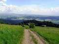
This route could be started on border-crossing point Bukovec-Jasnowice. You drive through Silesian Beskydy up to the town of Jablunkov. You continue downstairs from Beskydy Mountains up to Těrlicko-Dam and continue via Ostrava-Bohumín industrial area, driving via town of Orlová to Bohumín. Here, on border-crossing Bohumín-Chalupki, you leave Czech Republic. Anyway, you return from Poland after several minutes to Czech territory again, via border-crossing Chalupki-Šilheřovice. From here, you follow marked cycling route No. 6091 and 6094 up to the community of Píšť. From here, you continue via Chuchelná and Štěpánkovice, following cycling route No. 6092, and shortly reach the town of Opava. From here, you drive along cycling route No. 55 on border-crossing Vávrovice-Wiechovice. Further, you follow Polish route No. 34 up to border-crossing Branice-Úvalno, where you join again route No. 55 and drive up to the town of Jeseník. From here, you drive to the town of Krnov, and continue further via Linhartovy up to the town of Albrechtice. From here, you drive upstairs into Jeseníky Mountains. You pass the communities of Holčovice and Heřmanovice, where there is a possibility to follow marked cycling route No. 6072 and you reach consequently the town of Zlaté Hory. You drive straight ahead along road No. 453 up to the community of Rejvíz, continuing road No. 450 to the left, where you follow consequently cycling route No. 55. After several minutes, you turn to the right and reach the community of Drakov. From here, you drive to crossroads, where you turn to the right and drive throughout forests to Rejvíz. Further, you continue along forest path following cycling route No. 55. This route returns, after couple of minutes, on road No.453, and you follow this route up to the town of Jeseník.
Route length: 230 kms
Character: this route is quite difficult.


Localities:

Important Information:
![]() Information and warnings on travelling abroad is to be found HERE.
Information and warnings on travelling abroad is to be found HERE.
Mobile application:

![]()
![]()


