
Region of Hradec Králové - Czech republic
REGION OF HRADEC KRÁLOVÉ
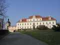
The Landscape of Český ráj (Bohemian Paradise) is not to be neglected part of this region.
According to the title – Bohemian Paradise - you can conclude that it is something really extraordinary. Nevertheless, for the local citizen it is something standard, normal as anywhere place in the country.
| Basic information about region Localities Subjects | Articles Photogallery Videogallery | Discussion |
Localities
Following Rampušák
Cycling of curve
Rychnov nad Kněžnou district
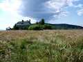
You can start your excursion in plain land, in order to make good training and have a look what exactly would be waiting for you. Your excursion could be started from the community of Skuhrov nad Bělou. You drive in direction to communities of Proloh and Osečnice, up to the place of Lomy. From crossroads, you mount along narrow road, following yellow marked tourist trail. After two kilometres of drive, you turn aside to the right, descending down asphalted road. You drive small section on not asphalted surface, but ahead, passing community of Jedlová, you drive on asphalted surface again. Passing Deštné, you mount upstairs towards Šerlich Gap, following marked cycling road No.22, not far distant from Masaryk Cottage. Now, you drive along red marked tourist trail, and overcome final mounting to Velká Deštná (1115 metres above sea level), the highest peak of Orlické Mountains, arriving to parking place „Pod Homolí“.
Further, you pass around, from left part, Střední vrch and Tetřevec, mounting, shortly afterthat, upstairs, following green marked tourist trail, up to crossroads „Pěticestí“ (Crossroads of Five Paths). Now, you drive back along the range, but on the opposite part, along unmarked path (passing between yellow and red marked tourist trails), back near to Tetřevec, finishing at parking place „Pod Homolí“.
You continue your drive in opposite direction, mounting steeply along the slope of Orel (Eagle). After one kilometre distance, you turn aside to the left, and through this abbreviation, you reach asphalted road, leading along isohypse between Orel (Eagle), Vřesník and Maruša. Further, you join green marked tourist trail and descend carefully into Luisa Valley. You follow green marked tourist trail up to the place of Zámeček (1,5 kms). From here, you turn to the left in direction to Velký Uhřínov, and shortly afterthat, you make long descent down to Skuhrov nad Bělou.
Route length: 58,5 kms
Character: this route has middle stage of difficulty


Regions / Europe / Czech republic

Guide:
Important Information:
![]() Information and warnings on travelling abroad is to be found HERE.
Information and warnings on travelling abroad is to be found HERE.
Mobile application:

![]()
![]()


