
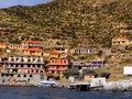
Bolivia – Coroico Village
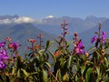
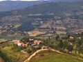
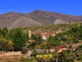
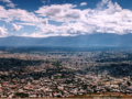
Coroico is situated at 1600 meters on the slopes of Cerro Uchumachi hill, Nor Yungas province, western Bolívia. There is hilly forest landscape around. Snowy caps of Cordillery Real – Huayna Potosí, Tiquimani, and Mururata are visible on the background.

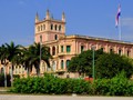
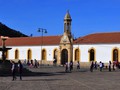
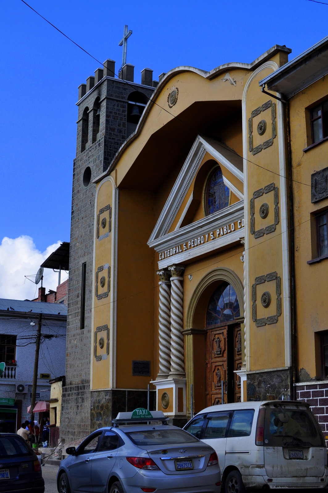
The village is small and quiet. The center is full of greenery. There is a beautiful church with a stone belfry adjacent to it (San Pedro y San Pablo). The church is the main sight in this area. There is tanqui bird depicted at several places in this village. It is a red bird with crest. The bird is local smybol. There are narrow paved roads in this village. Stores selling small things line the streets. There are several stand selling grilled chicken opening every evening. And every day everything goes upside down when bakers start selling freshly baked bread rolls.

We stay in Coroico until three a.m. We intende to enjoy local forests and walk in the surroundings. We set off to three waterfalls on the first day. These are about 2 hours of travelling from Coroico.

The trail follows green coca fields. Women and children work there. The further we get from the village, the more covered with vegetation the road gets. We get scratches and there are annoying little flies biting you and leaving you with red skin. For we are in quite low altitude, it is very warm and humid there.

The first waterfall – San Felix – is deformed by concrete. It seems like Cruz Loma drains water from it. We go towards two other waterfalls. This time we reach only stone roadblock with a barbed wire fence. It is so well positioned on the meter-and-half wide road that there is one a steep cliff on one side and steep slope on anotehr. We realize that this is no way to reach the waterfalls. The only way goes from Cruz Loma.

The toll guys seem to be uninerested in standing somewhere in the forest at a waterfall. They collect money rather down in the city. They rather made roafblock on thus road so nobod would reach the waterfalls differently.

We set off to the nearby peak of Uchumachi on the following day morning. It is almost 2500 meters above sea level. The way of the cross, which is popular here, goes to the small church. A dusty path then goes from there to the scenic platform where you can enjoy the low green hills of Yungas region. There are icy peaks of the Cordillery Real behind them.

Morning fog is a frequent phenomenna here. It is now slowly recedin. The sky is turning blue and we can see black-and-chestnut eagles hovering aove our heads Then the path narrows to only half a meter while bushes and grass raise up above our heads. Then trees create sort of a vegetation tunnel. We are grateful to see at least hints of some path. Then we reache the peak of Uchumachi. We rest at our places and enjoy vistas. However, the mountain is covered with trees. On our way back, some vagrant dogs get as close as a meter before us. Usually, dogs only bark in Bolivia. They don't approach you. However, they show their teeth. Not having a sweatshirt and rocks only god knows wa would have done wih their teeth.

The cemetery which is not much maintained and at some parts of it even daunting is another point of interest in Coroico, apart from possibility to make trips around the city, walk in the city or getting to enjoy beautiful vistas. The dead are usually burried above the ground in Latin America. This is due to often rocky bedrock. Often, they are even burried in concrete buildings where are openings for coffins. Such a structure is often 2 and half meters high, has over two meters in depth and around 2–15 meters long which depends on concrete size of a cemetery. Often, a coffins is set in concrete or walled up with a memorial plaque set onto the fore part. It is sort of a panel house for the dead... Some of these tombs are opened and plundered. There is even a mouldered coffin without a body.

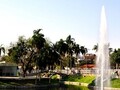
We spend evening in Coroico as the locals do – sitting on the main square. There are several benches there. It is warm evening in Coroico and light breeze. Weeks earlier, we were situated at higher altitude, meaning it was cold after the sunset. Now we enjoy the warmth and we have fun observing local kids play. It is nice that there are so many people on all Bolivian squares. They have fun, including children, they spend their free time outside and not sit at the computer at home. Partly for the fact that they don't own any.
GPS: 16°11'17.7"S 67°43'40.1"W
Text and photos: Tomáš Novák
| Discussion at the article (0) |
Related Articles
Paraguay, Asunción - peaceful capital city
Bolivia – Santa Cruz de la Sierra
Bolivia, Samaipata - a peaceful village
Bolivia – the beautiful city of Sucre
Bolivia - the colonial city of Potosí
Bolivia – Uyuni and Salt Pan
Bolivia – Torotoro National Park
Bolívia – metropolis La Paz
Bolivia – Copacabana and Isla del Sol
Bolivia, Cochabamba – Lets Go to Central Bolivia
Related Photogallery
Bolivia – The Heart of South America


Guide:
Important Information:
![]() Information and warnings on travelling abroad is to be found HERE.
Information and warnings on travelling abroad is to be found HERE.
Mobile application:

![]()
![]()


