
Český les (Bohemian Forest) - Czech republic
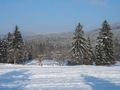
Český les is a highland situated in southwest Bohemia nedar to the border with Germany.
This mountain-range is extending from Cheb-Basin ap to Všeruby-Hignland dividing Český les from Bohemian Forest. The highest point is Čerchov ( 1042 m), where you can find Kurz look-out-tower, according to Dr.Vilém Kurz, founder of Czech Tourists Club.
| Lokalities Subjects | Articles Photogalery | Videogallery Discussion |
Lokalities

Through Chodsko region up to Furth im Wald
Cycling of curve
Domažlice district
This route belongs to those of middle difficulty. We start our excursion from colourful town of Domažlice with a lot of tourist highlights along marked cycloroute No. 2014 via community of Tlumačov. We continue around Spálený vrch (Burned Hill) and drive through Natural Park of Český les.The route leads us to border-crossing Ovčí vrch (Sheep Hill)/ Hochstrasse. We visit German town of Furth im Wald and continue via communities of Gaishof and Schachten to another border-crossing of Všeruby/Eschlkam. In Všeruby-village, we reach the cycloroute No. 2014 and drive through so ćalled Všeruby-Pass, dividing Šumava from Český les, passing Všeruby-pond via Hájek. On right side, you se Shrine Baroque Church St.Anna-Tannaberg (of 1712), from hillside there is a wonderful view. We continue our drive round Klepný Hill and communities of Kout na Šumavě and Mrákov. On right part, on hillside over a pond, near to community of Smolov, you find a Slavonic piece of ground from 10.-12th century, probably former administrative centre of western Bohemia, called Tuhost, some mounds are preserved. Following Smolov Pond, we reach the road of 1st category with dense traffic, we return back to Domažlice.

Route length: 58 kms
Character: route of middle difficulty
Photo: Klára Svobodová


Mountains / Europe / Czech republic

Important Information:
![]() Information and warnings on travelling abroad is to be found HERE.
Information and warnings on travelling abroad is to be found HERE.
Mobile application:

![]()
![]()


