
Chřiby - Czech republic
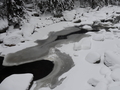
This highland is situated in Moravia between the towns of Kyjov and Kvasice in regions of South Moravia and Zlín. Its length is 35 kms and width max. 10 kms. The surface of Chřiby hill is 335 square kilometres. The highest peak – Brdo – has the height relating to 587 m.
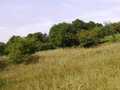
As to geomorphology: Chřiby forms part of geomorphological area of Middlemoravia- Carpathian Mountains and subprovince external West-Carpathian Mountains.
As to its position: the hills divide ethnographical area of Haná on north from Slovácko in south. Chřiby-hills border with Litenčice-highlands in north, with Ždánický les (forest) in west, with Kyjov-highlands in south and with Low-Moravian and Upper-Moravian Dale in east, following Morava-river.
| Lokalities Subjects | Articles Photogalery | Videogallery Discussion |
Lokalities


Mountains / Europe / Czech republic

Important Information:
![]() Information and warnings on travelling abroad is to be found HERE.
Information and warnings on travelling abroad is to be found HERE.
Mobile application:

![]()
![]()


