
Železné Hory (Iron Mountains) - Czech republic
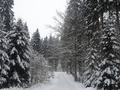
These hills are situated on north-west part of Bohemian -Moravian Highlands, its highest point is Vestec (668 m). According to the geomorphological arrangement it is dividing to Chvaletice-Hills and Seč-Highlands. In the southern part it is extending the natural reservation of Doubravka Valley. The whole area is, thanks to its position, preferred holiday, touristic and cyclotouristic resort.
| Lokalities Subjects | Articles Photogalery | Videogallery Discussion |
Lokalities
Podobravská cycling Route
Cycling of curve
Havlíčkův Brod district
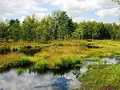
Your excursion could be started from the community of Radostín via Hluboká, following cycling route No.5127, passing nature monuments of Řeka and Štíří důl. You pass the communities of Krucemburk and Ždírec nad Doubravou, and you enter Preserved Nature Area of Železné hory (Iron Hills). Further, you continue via Podmoklany, and across communities of Bezděkov and Dolní Sokolovec, you arrive to Libice nad Doubravou.
Here, you turn aside to the right, and afterthat to the left, following the road towards Lány, and continue, passing the community of Maleč, you leave this preserved nature area, driving towards communities of Čekovice, Jeřišno, Chuchel up to Běstvina. You drive throughout Doubrava Nature Park, and your way continues across Pařížov and Heřmanovice to the community of Vilémov. Here, you turn aside to the right, in direction to Spytce. Here, you turn to the left, and continue, around Jesuits´ Pond, up to the town of Golčův Jeníkov, where your excursion is terminated.
Route length: 52 kms
Character: this route is quite easy


Mountains / Europe / Czech republic

Important Information:
![]() Information and warnings on travelling abroad is to be found HERE.
Information and warnings on travelling abroad is to be found HERE.
Mobile application:

![]()
![]()


