
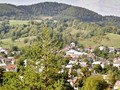
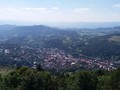
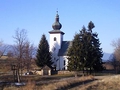
Kremnické vrchy (Kremnica Hills) - Slovakia

Extent: 488 km²
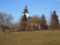
The hills are to be found in Central Slovakia in districts of Žiar nad Hronom, Banská Bystrica, Zvolen, Turčianske Teplice and Prievidza. This hill range belongs to the area of Slovak Ore Mountains, forming part of West Carpathian Mountains.
Highest peak: Flochová (1318 m).
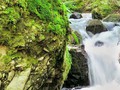
Surface: in lower situated localities there are leafy woods, mostly oak forests, in higher situated localities pine-trees. Local forests are protected, as they are predominantly of virgin forest character. Fields, meadows and glades are to be found in areas, where forests are missing.
Climatic area: moderately warm and colder.
The foundation of Kremnica Hills is referred to volcanic activity. In past, there were mined rare minerals here, such as gold, silver or copper.
| Lokalities Subjects | Articles Photogalery | Videogallery Discussion |
Articles
SK, Kováčová: An Ideal Place to Rest and for Activities in Nature – VIDEO
SK, Region of Banská Bystrica – Important Mining Region III
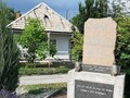
SK: Marian Columns – Stone Witnesses of Victories over Epidemics IV
SK, Malachov – A Place Ideal for Tourism II
SK, Malachov – Ideal Tourist Spot I
SK, Kremnica – Tourism as It Should Be
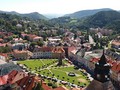
SK, Kremnica – City of Humor and Coins
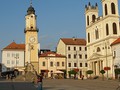
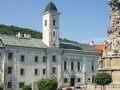
SK, Banská Bystrica – Central Slovakian Gem

SK, Banska Bystrica –SNP Memorial
SVK: Kremnické Bane - Geographical Center Of Europe


Mountains / Europe / Slovakia

Important Information:
![]() Information and warnings on travelling abroad is to be found HERE.
Information and warnings on travelling abroad is to be found HERE.
Mobile application:

![]()
![]()


