
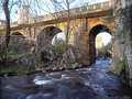
River Černá (jihočeská) - Czech republic
Novohraddské Mountains
17 km
| Basic information about river river sections Kilometrage Localites | Services Article Fotogallery Videogallery | Discussion Water stages |
Localites

Novohradský circuit
Cycling of curve
České Budějovice district
Your excursion could be started from the town of Nové Hrady. You pass Buquoy Parentage tomb, and follow marked cycling route No. 34 towards cross-border Nové Hrady/Pyhrabruck. You continue along cycling route No. 48, around Veversky Pond. After a while, you can turn to the right (marked cycling route), but you can go straight ahead and join this route at the community of Sejby. You drive through, on cross-roads you turn to the left, and after 500 m, passing Stropnice brook, you turn to the left. You drive again 500 m ahead, turn to the right and go up, through Vysoká Hill-side, passing Hojná Voda virgin forest, and start to drop.
On cross-road, you turn to the left and drive into Lužní potok (Meadow Brook) Valley. Consequently, you mount Jelení Hřbet (Deer´s Range), drive around and pass Zlatá Ktiš Pond. Further, you continue, following the way along Černá-river, and on the road, you turn to the left in direction to Žofín. You continue ahead up to Huťsky Pond, on its pier turn to the left and through the col, below Stříbrný vrch (Silver Hill), to the left, following the way, being as a circuit, between state border and fencing of Žofín virgin forest, leading you back to Žofín. From here, you follow green marked tourist trail to crossroad Pod Točníkem, down to the road, continuing towards the community of Hojná Voda. From here, there is a quick descent to a church in Dobrá Voda. Here, we recommend you to have a stop.
Further, you continue to the community of Horní Stropnice, turn aside in direction to Svébohy, but immediately turn to the right in direction to Humenice. From here, you continue to a pier of a water- reservoir of the same name, you cross it, and see Cuknstein castle ruin. From here, you follow red marked tourist trail in direction to Nové Hrady.
Route length: 57 kms
Character: this route is of middle difilculty stage


