
River Jizera - Czech republic
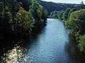
The Jizera river sources in Poland round the border on slopes of Smrk and enters to the Czech territory at the altitude of 885 m of sea level.
164 km
| Basic information about river river sections Kilometrage Localites | Services Article Fotogallery Videogallery | Discussion Water stages |
Localites

Paradise route (Cesta rájem)
Cycling of curve
Semily district
This cycling route belongs to quite difficult ones. From Turnov, you drive along the road, via community of Kaluznik up to Kacanovy. Here, you turn aside blue marked cycling route No. 4009, via Olešnice, Mlýnice and Skokovy up to Žehrov. From here, the marking trail leads to Příhrazy, and further, below northern slopes of Mužský Rocks up to the community of Olšina. On your way to Dneboh, you can watch Rock massif of Drábské světničky, pass Zásadka and turn aside to Valečov Castle, and return on your cycling route. So, you continue, following green marked cycling route No.4013 up to the community of Nová Ves, and drive along cycling route No. 4009, around Komárov pond up to the community of Srbsko. Further, you continue, driving to Kost Castle. Its sightseeing is very interesting, it is worth to do it. Your cycling route continues across violent hill via community of Podkost, and at former Semtín linden-tree, you turn aside to the community of Libošovice, following cycling route No. 14 just to Pleskot Mill-building, and along cycling route No.4010 around Věžák pond. Your way continues via the community of Želejov up to Troskovice. Here, a visit of Trosky, castle situated on volcanic hill, is to be offered. You drive to Hrubá Skála castle, and here turn to the right, before the road starts to mount violently. You drive through marvelous rocky section slowly and with respect to foot passengers from Sedmihorky Spa. You shortly reach this place, so a way via Pelešany up to the town of Turnov (with views upstairs to the rocks and Valdstein Castle) remains to you.
Route length: 55 kms.
Character: this route is quite difficult – middle stage difficulty.
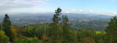
Photo: Google Earth


