
River Loděnice - Czech republic
The brook sources in Křivoklát-Highlands northern of Řevničov in an altitude of 478 m of sea level.
61 km
| Basic information about river river sections Kilometrage Localites | Services Article Fotogallery Videogallery | Discussion Water stages |
River description:
The navigability of this brook is depending on heavy rains or letting out of ponds on its upper part. It is not, however, quite often. As tgo lower flow – you can estimate it in Hostim. The navigation on upper part is difficult , owiung to laying trees in river-bed , therefore it is not quite comfortable. On lower flow you can be surprised by overgrown on banks and low foot-bridgeas.
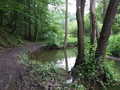
The brook springs in Křivoklát-Highlands , it flows first to the east. then turns in southeastern direction and to the south. It mouths to Berounka near to tetín from its left part. Its river-basin makes 271 km2. Kačák brook flows through open, in its upper part mostly meadow valley, later afforested. Small river in its last section cuts deeply to the terrain and raises its slope. Its bed is wide of 4-8 m and stony, with moderate rapids. In its middle-flow the bed is overgrown and the weirs are not navigable. Quite interesting is the last section – from Loděnice to its mouth.
Accommodation:
A camping place is to be found at Chrustenice and at Srbsko along Berounka river.
The accommodation you find in towns along the river.
Food supply:
It is available in Malé Kyšice, Loděnice and Srbsko.
First aid:
It is available in health centre in Beroun.
Places of interest:
- Svatý Jan pod Skalou: a monastery.


