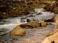
River Malé Labe - Czech republic
spring (source):
The river sources on southwestern slope of Back Table-land (Zadní planina) in Giant Mountains in an altitude of 1320 of sea level.
The river sources on southwestern slope of Back Table-land (Zadní planina) in Giant Mountains in an altitude of 1320 of sea level.
flow length:
24 km
24 km
| Basic information about river river sections Kilometrage Localites | Services Article Fotogallery Videogallery | Discussion Water stages |
River description:
The river sources under Zadní planina ( Back Table-land) in an altitude of 1320 m as Klínový brook. It flows to the south and near to Hostinné mouths to Elbe-river from its left side.
The length of navigable section makes 14 kms.
Food supply:
It is available in Horní Lánov and Hostinné.
First aid:
It is available in health centres in Horní Lánov and Hostinné.