
River Rokytka - Czech republic
The river sources near community of Tehovec in an altitude of 453 m of sea level.
20 km
| Basic information about river river sections Kilometrage Localites | Services Article Fotogallery Videogallery | Discussion Water stages |
Localites
From Klánovice To Klepecké Small Stones
Cycling of curve
Prague - East district
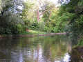
This cycling route has a middle stage of difficulty. Your excursion could be started in Klánovice, at railway stop. You drive, passing „Kolomazná pec“, towards school building and turn aside, following green marked tourist trail, tinto a forest. You pass two ponds, situated on Blatov brook, across resting place at Nové Dvory and subway, in direction to the community of Blatov. Further, you continue your drive throughout Pilovská Street at the edge of Blatov, cross carefully frequented Starokolínská road, and behind, passing Oplanska Street, to the community of Koloděje, to a castle. Further, you make diversion around castle preserve, in quarter of Hájek, you turn aside to the left, passing Pod Marketou Street, and on your drive to Královice, you pass, on your left side, small Rokytka dam (good possibilities for bathing).
From Královice, you continue your drive via communities of Křenice, Březí, Babice, Mukařov, Žernovka, up to Štíhlice. From here, you continue your way, following yellow marked tourist trail, up to crossroads „Na Zámkách“. From here, you follow red marked tourist trail through wild valley of Šembera brook on the road, mount up to the community of Doubravčice, and further, across Masojedy and Hradešín up to the village of Přišimasy. You arrive shortly towards east edge of Přišimasy, known as Skřivany. On crossroads, at stone cross, you drive along field path with blue marked tourist marking. On near afforested hillock, a surprise, known as Klepec, as waiting for you. From here, you return to Skřivany and drive in direction to the community of Úvaly. At the edge of the forest, you turn aside to the right, across railway line. After railway crossing, in 800 metres distance
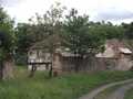
a gamekeeper´s house Hodov is to be found. From here, there is leading a diversion throughout the forest, directly to Masaryk School in Klánovice. You continue you drive along the road up to the community of Nové Jirny, turn aside to the first street on left, and continue ahead, passing small chapel, straight up to Cyrilov crossroads. From here, you follow yellow marked tourist trail, passing the bank, and continuing towards school building in Klánovice.
Road length: 49 kms
Character: this cycling route is of middle stage of difficulty


