
River Sázava - Czech republic
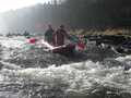
Sázava flows, at first, as a small river from Velké Dářko pond.
225 km
| Basic information about river river sections Kilometrage Localites | Services Article Fotogallery Videogallery | Discussion Water stages |
Localites
From Nové Město Around Paseka And Pohledec Rocks
Cycling of curve
Žďár nad Sázavou district
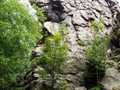
This route has middle stage of difficulty. Your excursion could be started from holiday town of Nové Město na Moravě, where you can find a lot of places of interest. You drive along marked cycling route No.19 across the community of Zubří. On your left part, there is placed Zubří pond, destined for relax. You continue your drive via Vojtěchov up to the village of Lhota, where you join marked cycling route No. 1. You drive throughout protected countryside area Žďárské Hills, via Koníkov. On your left part, there is arising Pohledec Rock, created from biotic gneis¨s (this rock is unaccessible), and shortly, you arrive to the community of Studnice (village with the highest altitude above sea level - 784 m – in Bohemia Moravian Highlands), where you can admire typical houses of mountain character.
Further, on your left part, you can se Paseka Rock Hill, including top rock blocks of Pernstejn, Pecen and Vyhlídka (monument of the same name).
In the community of Kadov, you join marked cycling route No.103 and continue, driving through mountain village of Fryšava pod Žákovou horou and Tři Studně (Three Wells), holiday resort. Shortly afterthat, you pass holiday ponds of Medlov and Sykovec, and return to Nové Město na Moravě again.
Route length: 36 kms
Character: this route has middle stage of difficulty


