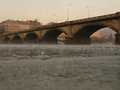
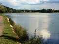
River Vltava - Czech republic
spring (source):
Vltava river is created by confluence of Teplá (Warm) and Studená (Cold) Vltava in a natural preserve Mrtvý luh near to the community of Nová Pec in Bohemian Forest.
Vltava river is created by confluence of Teplá (Warm) and Studená (Cold) Vltava in a natural preserve Mrtvý luh near to the community of Nová Pec in Bohemian Forest.
flow length:
430 km
430 km
| Basic information about river river sections Kilometrage Localites | Services Article Fotogallery Videogallery | Discussion Water stages |
Localites
Dolní počernice - Dolní Měcholupy
Locality type:
In-line Locality
In-line Locality
Place:
Dolní Počernice, Dolní Měcholupy, Štěrboholy
Dolní Počernice, Dolní Měcholupy, Štěrboholy
Cycloroute of good quality leading from children playground between jahodnice and Dolní Počernice along Hostavice brook. After road-crossing to Národních hrdinů street the way continues between fields and meadows, under so called Jižní spojka (South communication line) and after 1 km crosses the road to Dubeč. Further, it continues along Slatina basin, following always Hostavice brook. The path terminates with concrete blocks at mouth to Kutnohorská road between Štěrboholy and Dolní Měcholupy.
Access: arrival from Českobrodská road by bus or by car – parking possibilities are in neighbouring streets (Lomnická, V Záhorském, Bohuslavická).
In opposite direction: arrival on Kutnohorská street – by bus or by car. Parking is possible in Dolní Měcholupy (Mondeo). and near Kutnohorská street.