SK, Tatras – Tourist Book Guide Introducing Many Points of Interest

The publication Tatry presents the most beautiful Slovakian mountains as you do not know them. The quantity of illustrative material combined with eye-catching text and interesting graphics will attract not only permanent visitors to the Tatras, but also those who are just beginning to discover them.

The book is logically divided into Eastern and Western Tatras and includes chapters on history, nature, culture and tourism. There are also tips for hiking, cycling and practical information. More than 500 photographs, maps, pictures and illustrations complement the image of the Tatras, yet untreated. The author of the publication is Juraj Kucharík.

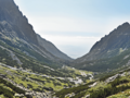
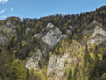
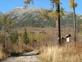
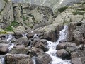
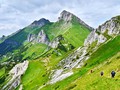
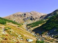
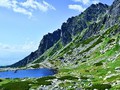
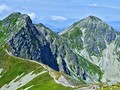
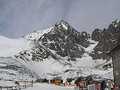
The tourist guide will take you through the most beautiful corner of Slovakia, as Tatras excel in comparison with other Slovak mountains. You will learn that they are Europe's highest inland mountain range in the area between the Alps, the Caucasus, the Urals and the Arctic Ocean, and that the territory of the Slovak part is approximately 1.7 times the size of Bratislava or 1.2 times the size of Prague, and in a small area you can find high peaks, glacial valleys, waterfalls, promes, rich flora or wildlife.

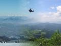
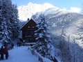
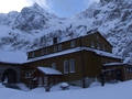
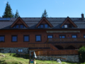
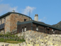
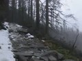
Tatran fauna is often formed by endemic species (Tatra chamois, Tatra mountain marmot and Tatras vole, are also glacial relics, i.e. ice age organisms). Furthermore, you will find protected areas, promenades, caves, spas, mountain huts and unconventional transport (cog railway, tram, funicular railway, cable cars).

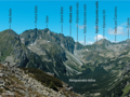
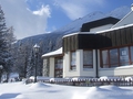
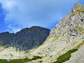
Toto vysokohorské pohoří má i řadu nej. Kromě toho, že Tatry jsou nejvyšším pohořím na Slovensku a nachází se zde největší i nejhlubší slovenské jezero, patří k nejchladnějším územím v zemi. Z výškových rekordů zmíníme nejvyšší vrchol Gerlachovský štít, nejvyšší lanovkou dostupný vrchol Lomnický štít, na jehož vrcholu se nachází nejvýše položené obydlené místo, observatoř, stanice lanovky i malá botanická zahrada. Zároveň jsou Tatry nejnavštěvovanější částí Slovenska.


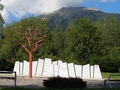
Be inspired by the new Tatry book tour guide, which you will find in every good bookshop and e-shop. Set out for the Tatra adventure. Of course, this time you have the chance to win this engaging book! Just write us your favorite place in the Tatras on 4gsyQOQa9~Bq2~6_Tlx and you are included in the draw. This will happen on July 8th and the winner will be posted on our social networks.
GPS: 49°09'52.2"N 20°08'01.3"E (Gerlachovský Pyramidal Peak)
Source and photos: PR, Dajama publishing
Edited: Infoglobe
| Discussion at the article (0) |
Related Articles
SVK: Safely On The Mountains II. - High Tatra

SK, Colorful Life of Bird Areas

SK, A Story of Different Side of Slovakia
SK: Walking with a Book - The Tatras from Sidewalk
SK: Discovering the Mysteries of Slovakia
SK: High Tatras – A Walk Along Spa Pathway
SK, High Tatras – Hrebienok
Slovakia: Safely To The Mountains IV. - Western And Low Tatra
SK, High Tatras - Climbing up the Furkotsky Shield
SK, High Tatras – Bilík’s Cottage
SK, High Tatras – Cottage by Zelené pleso I
SK, West Tatras – Žiarska Cottage
SK: Belianske Tatras – Crossin Siroke Seat
SK: High Tatras – Trek Up to Jehneci Pyramidal Peak
SK: High Tatras – Téry Cottage
Related Photogallery
SK: Western Tatras – Across Rackova Valley to Bystra
SK: High Tatra Mountains – A Trek Across Mlynicka and Furkotska Valleys
SK: Western Tatras – Trek to Tri Kopy and Banikov
SR, High Tatras: Nový and Starý Smokovec
SVK: High Tatra mountain - Lomnický Peak
Related Videos
SK: High Tatras - Disastrous Year of 2004


Guide:
Important Information:
![]() Information and warnings on travelling abroad is to be found HERE.
Information and warnings on travelling abroad is to be found HERE.
Mobile application:

![]()
![]()