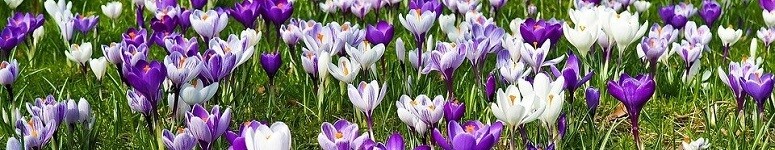
SK, Liptovský Mikuláš – Amazing Hill of Háj

The availability of the forest park is more than excellent. The Path of General P. Kuna leads to it, named after an important participant in the Slovak National Uprising, who led the liberation struggles in Liptov. Unofficially, the route is also called the Path of Heroes.

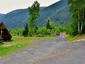
The asphalt road, which can be reached by car, on foot or by bike to the very top, is completed by two large car parks. Please note, however, that it is not maintained during the winter. More attractive for tourists, however, is the unpaved Hołna route, which gently copies the asphalt road from the railway crossing. In addition, you will find two nature trails on this route.

The Nature and Landscape nature trail (1.3 km), leading along the green mark from the railway crossing to the Háj lookout point, will take you around a century-old poplar, insect house, meadow, children's playground and time steps that capture the geological bedrock of the Liptov Basin. You will suddenly go back in time by 460 million years.


From the Háj viewpoint, follow the red sign along the Military History nature trail (0.47 km), which will take you through the second most difficult battles of World War II in Slovakia, where Liptovský Mikuláš was fought for a long 62 days. You will learn about the fighting troops, the weapons used and the restoration of devastated Liptov. The trail ends at the reverential area.

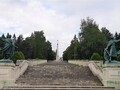
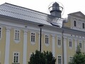
The monumental reverential area, opened in 1961 and declared a national cultural monument, will amaze not only the monument with a 15-meter pylon, which leads to a staircase with a sculptural group, but also the largest war cemetery of Czechoslovak soldiers in the former Czechoslovakia. 1369 members of the 1st Czechoslovak Army Corps, soldiers of the insurgent army and partisans found their last resting place here. In the lower part of the complex, in 2018, a modern monument was added to commemorate war veterans and professional soldiers who perished while performing tasks in foreign missions and operations.


In parallel with the nature trails, there are also cross-country trails of the St. Nicholas Olympians. From the already mentioned railway crossing, the cross-country (yellow) route of downhill skier Petra Vlhová starts with a length of 3.3 km and an elevation gain of 140 meters, and from the Háj viewpoint, the cross-country (blue) route of water slalom skier Michal Martikán with a length of 5.3 km and elevation gain of 175 meters.


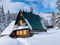
We must not forget the cyclists, who on the way from Liptovský Mikuláš to Žiarská dolina can diversify their cycling tour by turning to the top of Háj. If you hear shots, don't be afraid, because near this picturesque place is the first ecological Slovak shotgun range. Even skiers will not come short, because on the eastern slope of the hill Háj (behind the monument) is the ski resort Podbreziny with an elevation gain of 115 meters. It has one ski lift and 2 km of maintained cross-country trails.

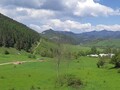
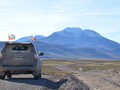
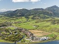
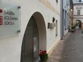
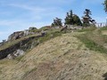
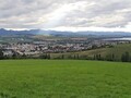
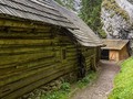
From the historic center of Liptovský Mikuláš, the beginning of the forest park (at the railway crossing) is only 1.5 kilometers away, which is less than 20 minutes walk. In another 45 minutes you will reach the very top of Háj (748 m above sea level). First you will be attracted by the panoramic view of the northeastern High Tatras, Western Tatras and the vast Choč Hills. You will also be able to observe the Low Tatras and part of the Velkofatranské mountains. There will also be views of the Podtatranská kotlina, built not only by the district town, but also by the picturesque villages and towns. The dominant feature is the water level of Liptovská Mara. A part of the view is also a shelter. A little further on, you will dive into the bitter memories of the past, which should not be forgotten.

There are not many such places in Slovakia, where after a short walk you will see amazing mountain scenery, you will remember the heroes who fell in battle, you will enjoy the magnificent architecture and sports activities in a quiet natural environment.

GPS: 49°05'06.2"N 19°37'43.5"E (railway crossing); 49°05'21.5"N 19°38'22.4"E (parking at reverential area)
Text and photos: Oskár Mažgút
| Discussion at the article (0) |
Related Articles
SK, Liptov - following the Celtic footsteps in Kvačany
SK, Jalovec – Skialping to the Cabin Pod Náružím
SK, Liptovský Mikuláš – Infofest 2020 Travellers' Festival Comes!
SK, Liptov – An Attractive Region for Spring and Summer Vacation
SK, Bešeňová: A Liptov Town Luring Tourists - VIDEO
SK, Liptovský Mikuláš – A Visit To the Museum of Nature Protection and Cave Exploration

SK, Liptovský Mikuláš – Fascinating World of Optical Illusions

SK, Liptovsky Mikulas – The Town of Olympic Winners and More I
SK: Liptovsky Mikulas – The Town of Olympic Winners and More II
SK, Liptovsky Mikulas – The Town of Olympic Winners and More III
SK, Liptovsky Mikulas – Namesti Zadosti Slovenskeho Naroda Square
SK, Liptovský Mikuláš – A Rest in The Region Popular Among Tourists
SK, Liptovsky Mikulas – Sightseeing

SK, A Trip Across the Villages of Liptov
SK: Tourist Trek from Kalameny to Liptovsky Castle
Related Photogallery

SK: Visiting the Museum of Nature Protection and Speleology
SK, Liptovský Mikuláš: Forest – Nicovô
SK: Liptov – A Walk Through Interesting Towns
Liptov: Oblazy Water Mills
SK: Liptov – Popular Tourist Region
SK, Liptovsky Mikulas – Downtown Liptov
SVK: Pribilina - Liptov Village Museum
Related Videos
SK: A Memory of INFOFEST 2020 Travel Festival


Guide:
Important Information:
![]() Information and warnings on travelling abroad is to be found HERE.
Information and warnings on travelling abroad is to be found HERE.
Mobile application:

![]()
![]()