Tschukotka - Russia - I.

Tschukotka autonomous area (it was national area till 1980) was founded on 10th December 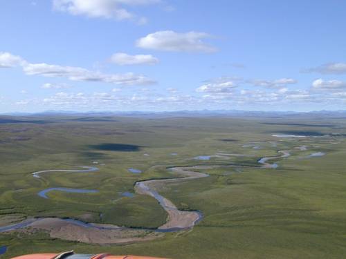 1930. Nevertheless, this countryside obtained a status of independent subject on 17th July 1992.
The extention of the whole territory makes totally 737,7 thousands of square kilometres. It is 7% from total surface of Russian Far East Area (in Russia known as „Border North“), including adjoining areas.
The area involves mainland between low river basin of Kolyma-river on west and Dezhnew Cap on Tschukotka Peninsula, including islands, as follows: Wrangel, Ayon, Arakamchent, Ratman, Herald, etc. This region neighbours (on mainland) with Sacha Republic (Yakutsk Area), Magadan Region amd Koryaksk autonomous area. Bering Straits divides Tschukotka from American State of Alaska.
Tschukotka is situated on north-east corner of Eurasia, between Pacific Ocean and Northern Ice Ocean. It neighbours also with East-Siberian, Tschukotka and Bering Seas.
As far as most southern situated place is concerened, it is Rubikon Cap (62° north latitude), most northern place is Selagsky Cap (70° north latitude), most western place is left bank of lower flow of Omolon-river (158° east latitude), and finally, most eastern places is those of Dezhnew Cap (170° west latitude), which is most eastern edge of Russia and the whole Euroasia at the same time.
Most part of Tschukotka is situated on eastern hemisphere, Tschukotka Peninsula – on western hemisphere, and nearly half of Tschukotka territory, even behind North Pole Circle.
Climate and Nature
The climate in Tschukotka is more rough as in neighbouring Alaska. The winter lasts too long and summer period is short. The temperatures of most warm month – July – vary betwwen + 4 up to + 14° C. The coastland belongs to most windy places in Russia. Record gales reach 80 m/sec. So, most of this peninsula has permanently frozen soil.
The seas, surrounding Tschukotka, are inhabitated with grey and Greenland whales, seals and walruses. In rivers, along Bering Sea coasts, Pacific salmons are reproducing. Water surfaces of peninsula are rich on fish, such as pikes and cod-fish. In Tschukotka, you can meet north deer or sheep. On the other hand, there are also to be found here Asian sables, polar fox, Siberian wolfs or brown bears. Inside Anadyr-river, including its tributaries, you can find weasel ermines, weasels or lynx. Wrangel Island and Herald Island, including north coast of Tschukotka Peninsula, are main areas for reproduction of ice bears. Along coast of sea and lakes, an Arctic tundra and forests, you can meet nesting places of grey sea-gulls and Canadian crane, snow geeses and white-cocks, forest hawks or cuckoos are to be watched.

Tschukotka´s world of plants is very variegated – from small plants of Arctic tundra up to thick afforeseted copse of larch-tree taiga.

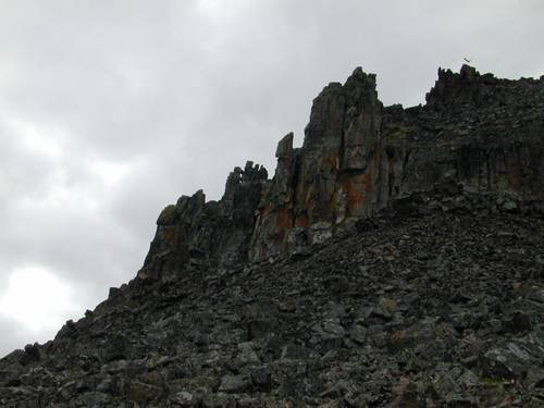
In Tschukotka, there are to be found many mineral springs, serving as a home for many rare sorts of plants in peninsula. In depth of Tschukotka Peninsula, there are hidden stratta of gold, lead, silver and copper, tungsten, mercury, platinum metals, petrol and gas, coal and other raw materials.
Text: Maxim Kucer, Slava Pavlyuk
Translation: ing. Jan Jonáš
Foto: Слава Павлюк, Петр Тихомиров
| Discussion at the article (0) |


Guide:
Important Information:
![]() Information and warnings on travelling abroad is to be found HERE.
Information and warnings on travelling abroad is to be found HERE.
Mobile application:

![]()
![]()