
SK, Liptov - following the Celtic footsteps in Kvačany
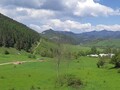
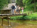
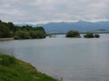
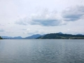
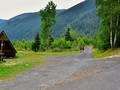
Kvačany is an imaginary gateway to the most beautiful and most visited Slovak valleys, namely the Kvačianska and Prosiecka valleys, which, in addition to rock cliffs, multiple waterfalls and caves, boast a unique wooden water mill. The Prosiecka and Kvačianska Valley Nature Trail, which is nearly 17 kilometres long and has an elevation of 500 metres, will take you through this natural gem. As this is a moderately demanding route, you should consider doing it as a whole.

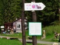
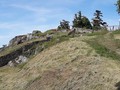
Today we will go to just one of the stops on this nature trail, namely number 13, which tells about the settlement of the Celts. The educational board and the site itself are located at the end of the local part of Dlouhá louka (behind the cooperative). You will know it at a glance as there are former terraced limestone quarries.

The quarry sites were already inhabited by people of the Púchov culture (Celts in the broader sense) in the so-called Latenian period at the turn of the 3rd and 2nd century BC. Convincing evidence in the form of an iron spear was found in the 1970s and subsequent archaeological research by the Slovak Academy of Sciences confirmed the settlement definitively.
")
")
")
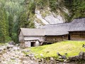
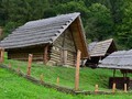
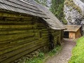
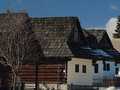
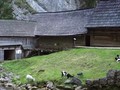
The Celts had built a settlement on the local terraces consisting of wooden log cabins covered with straw or bark, and pigsties were built next to them. Their agricultural and artisanal way of life gradually changed the surrounding landscape into the form we know it today. If you were to walk to the crest of the adjacent hill, you would discover the remains of a fortified hillfort with a sophisticated defence system. The structure of the hillfort and the location of the settlement support the theory of a settlement before the arrival of the Púchov culture.


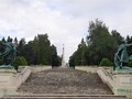
You will move along the forest path, whose existence dates back to prehistoric times and connected Liptov with Orava. At the terraces you will come across a wooden cross with the corpus of the crucified Christ and a few tens of meters further there is a historical bell tower with a cemetery or a lookout tower providing a wide view of the Liptov basin.

Even children can manage an easy trip into the past, so don't hesitate to explore the lesser-known corners of Liptov.


GPS: 49°10'06.0"N 19°31'52.0"E
Text: Oskár Mažgút
Photos: Hory.sk, Matouš Vinš (1)
| Discussion at the article (0) |
Related Articles
SK, Huty - Mlyny Oblazy in Kvacianska Valley
SK, Horný Liptov – Inspiration for Tourists

SK: Liptovska Kokava – Machy Nature Reserve
SK, Liptov: Kvacianska Valley and Oblazy Water Mills - VIDEO

SK, Liptovsky Mikulas – The Town of Olympic Winners and More I
SK, Liptovský Mikuláš – Amazing Hill of Háj
SK, Liptovský Peter and Jamník – Traditional Townships of Liptov
SK, Liptov Region – A Summer Full of Experiences
SK, Liptovska Mara Dam – Paradise for Those Who Love Water Sports and Swimming

SK, A Trip Across the Villages of Liptov
SK: Tourist Trek from Kalameny to Liptovsky Castle

SK, Liptov: The Town of Ziar and A Hike into the Surroundings
SK, Liptov – Havranok Open Air Archeological Museum and a Solitary Tower
Related Photogallery
SK: Liptov – A Walk Through Interesting Towns
Liptov: Oblazy Water Mills
SK: Liptov – Popular Tourist Region
SVK: Pribilina - Liptov Village Museum
Related Videos
SK, Liptov: Kvacianska Valley and the Oblazy Water Mills


Guide:
Important Information:
![]() Information and warnings on travelling abroad is to be found HERE.
Information and warnings on travelling abroad is to be found HERE.
Mobile application:

![]()
![]()


