
River Ondava - Czech republic
The river sources in Low Beskydy Mountains, near to the community of Javorina.
125 km
| Basic information about river river sections Kilometrage Localites | Services Article Fotogallery Videogallery | Discussion Water stages |
River description:
This river sources in Low Beskydy Mountains, near to the community of Javorina. It flows mostly in south-east direction, across whole East Slovakia. Near to the border with Hungary, it forms, confluencing with Latorica, the Bodrog river. The length of navigable section is 125 kms, river basin takes 3380 km².
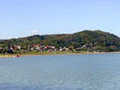
Ondava flows through wide valley as a flat river. Its river bed is covered with gravels with numerous sediments. In its upper section, the stream is quick, creating several small rapids. Anyway, the main stream is quite difficult to be found but the navigation is safe. In its low-land section, the banks are completely overgrown. The river creates many turnings, meanders, and river-bed cuts between clayish banks. The valley is getting narrow in some places. The hillsides are covered with leafy woods and form quite charming frame for a river. However, in its lower section, Ondava-river is hardly polluted. When entering into East-Slovakia low-land, river-bed is artificially straightened, regulated, and system of anti-inundation piers protects its environs against floodings. On the whole flow of Ondava, the weirs are missing.
Accommodation:
It is available in the town of Svidník.
Food supply:
It is available in Svidník, Stropkov, Hencovce and Bánovce nad Ondavou.
First aid:
It is available in Svidník, Stropkov, Hencovce and Bánovce nad Ondavou.
Places of interest:
- Svidník - starting point to Dukla Pass. Monument dedicated to Red Army, museum of Dukla fights, skansen of peoples´ architecture, gallery


