
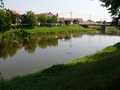
River Morava - Czech republic
The river sources under top of Kralický Sněžník in an altitude of 1380 m of sea level.
329 km
| Basic information about river river sections Kilometrage Localites | Services Article Fotogallery Videogallery | Discussion Water stages |
River description:
The biggest river in Moravia sources on slopes of Kralický Sněžník in an altitude of 1380.
It flows in southeastern direction. Near to Napajedla where enters to Dolnomoravský Dale it changes its flow in southwestern direction. In border belt, it flows, till its mouth into Danube, in south direction. The length of descended section makes 344 kms.
Accommodation:
It is quite easy to find it on the route.
Food supply:
It is available in places, such as Hanušovice, Ruda nad Moravou, Postřelmov, Litovel, Olomouc, Tučapy, Kroměříž, Napajedla, Uherské Hradiště, Ostroh, Veselí nad Moravou, Rohatec, Hodonín, Brodské
First aid:
It is available in health centres: Hanušovice, Litovel, Olomouc, Kroměříž, Napajedla, Uherské Hradiště, Veselí nad Moravou, Hodonín
Places of interest:
Litovel: Church, Old Town Hall, Museum.
Olomouc: see Bystřice (Olomoucká).
Kroměříž: Castle and three churches
Uherské Hradiště: Church, Old Town Hall, Armoury.


