
River Skalice - Czech republic
spring (source):
This river sources, under a name of Kotelský brook, in Brdy Forests near to Rožmitál pod Třemšínem in an altitude of 678 m of sea level.
This river sources, under a name of Kotelský brook, in Brdy Forests near to Rožmitál pod Třemšínem in an altitude of 678 m of sea level.
flow length:
52 km
52 km
| Basic information about river river sections Kilometrage Localites | Services Article Fotogallery Videogallery | Discussion Water stages |
River description:
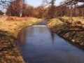
This small river is, in its upper flow to Mirovice, navigable after snow thaw in spring in Brdy Forests, or after heavy rains. Its middle section to Čimelice, is navigable at lowewr flow, however, its stony river-bed requires again a spring or rainy water. The orientative water register „ U Mostu“, would show 130 cm at least, however, for its final section it is required higher water level. On this section, there were constructed several stages, (near to holiday centres, however, some whirls create there, theay are dangerous at higher water level.
We recommend to check before navigation. The navigation on its upper section (it was not described in detail up to now) requires a certain skill in boat mastering, owing to sharp bendings. Anyway, further section to Smetanova Lhota, has plain character, the lower section proves again a waterman-beginner.
This river sources, under a name of Kotelský brook, in Brdy Forests near to Rožmitál pod Třemšínem in an altitude of 678 m. It turns to southeast and under the name of Vlčava, it flows to Březnice, and after that, as river of Skalice, flows, to its mouth into Lomnice river.
It river-basin makes 376 km². On its upper section over Březnice, Vlčava flows between fields and meadows, through overgrown clayish and partially stony river-bed. However, the slope is rather big, and the river flows quickly in sharp meandres. However, sometimes make the surprise laying trees over river-bed or sharp bending with a press to a bank. Anyway, before Březnice the road becomes wider, the river turns quietly in a countryside to Mirovice and Smetanova Lhota. Further, the river cuts deeper to terrain, the stones in wider river bed appear, and the river flows into afforested valley. On its final section, light rapids and several bouldary thresholds appear. This section reaches, at higher water level, its difficulty stage of VVVIII. The weirs are damaged, some of them navigable.
Accommodation:
You find it in Březnice and Mirovice, in Mirovice it is a camping place available.
Food supply:
It is available in Rožmitál pod Třemšínem, Březnice, Myslín, Mirovice, Čimelice and Varvažov.
First aid:
It is available in health centres in Rožmitál pod Třemšínem, Březnice, Mirovice and Čimelice.
Places of interest:
Rožmitál pod Třemšínem: castle, Baroque houses.
U Pátého Hamru: rests of former ironworks.
Březnice: Renaissance castle of 16th century.
Myslín: former Baroque Mill.
Mirovice: Stronghold, arranged in Renaissance style, Gothic church of 13th century.
Čimelice: Baroque castle of 18th century.


