
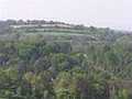
Myjava hilly Country - Slovakia
Site:
Myjava Hilly Country is placed in west of Slovakia, in Regions of Trnava and Trenčín, and in Senica, Myjava and Nové Město nad Váhom districts. This territory belongs to Slovak -Moravian Carpathian Mountains, which forms a part of Outer West Carpathian Mountains.
Extent:
371 square kilometres
The highest hill:
Bradlo – 543 metres above sea level
| Lokalities Subjects | Articles Photogalery | Videogallery Discussion |
Lokalities
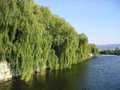
Kopanica cycloroute
Cycling of curve
This route starts in the town of Senec, and continues via the town of Myjava. Here, you can see Museum of National Council and monumental church. Further, you continue through so called Kopanice countryside, via Poriadi, Paprad up to the town of Stará Turá. Here, you can have a swim in summer in holiday area of Dubník. In this place, you can see Hussite tower. Further, you continue in the place of Čachtice, where Small Carpathian Line is to be crossed. Later, you reach Váh-cycloroute, where this way is finished.
Route length: 61 kms.
Character: this route is quite easy.


Mountains / Europe / Slovakia

Important Information:
![]() Information and warnings on travelling abroad is to be found HERE.
Information and warnings on travelling abroad is to be found HERE.
Mobile application:

![]()
![]()


